- Planet Earth
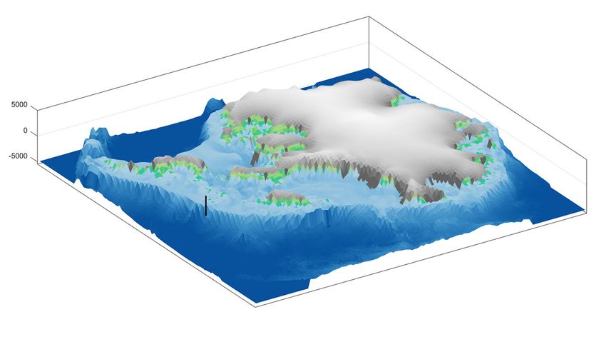
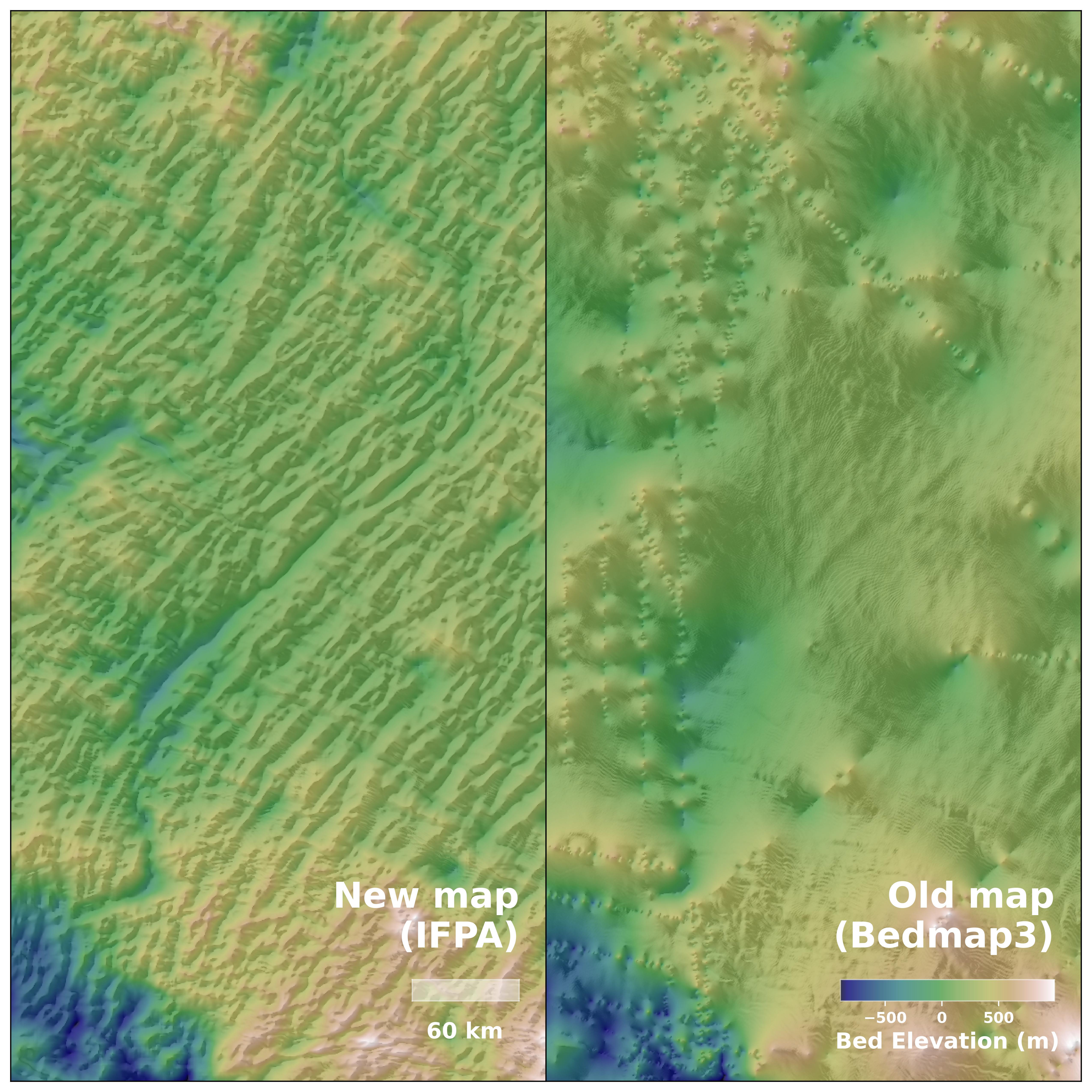
The map shows diverse geological features shaping Antarctic glaciers from below, which can improve climate models of ice melt.
When you purchase through links on our site, we may earn an affiliate commission. Here’s how it works.
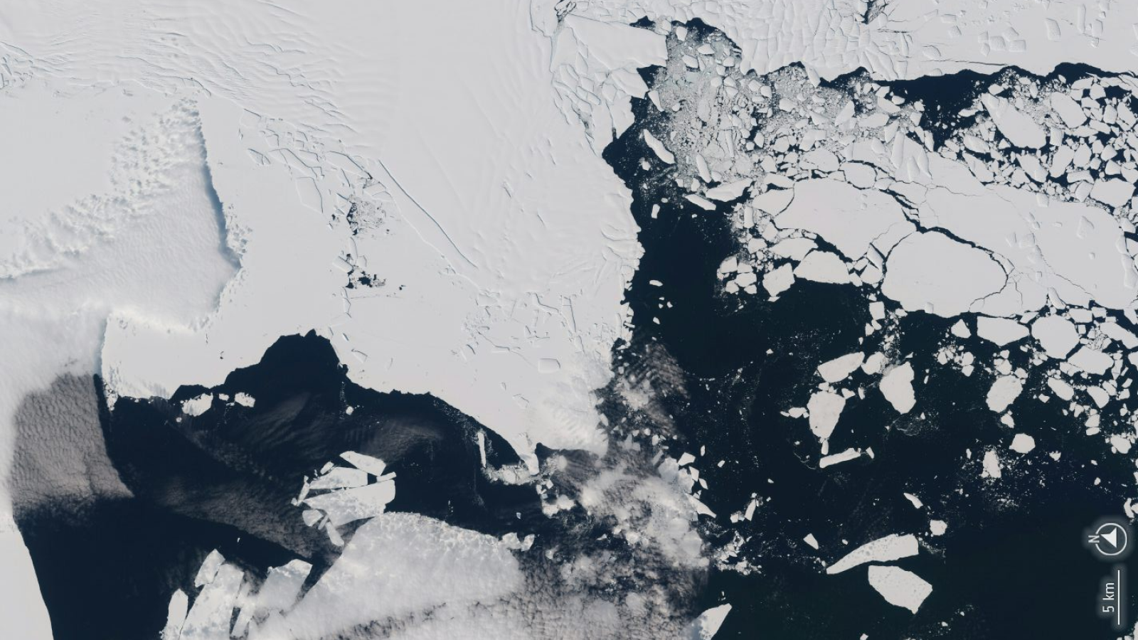
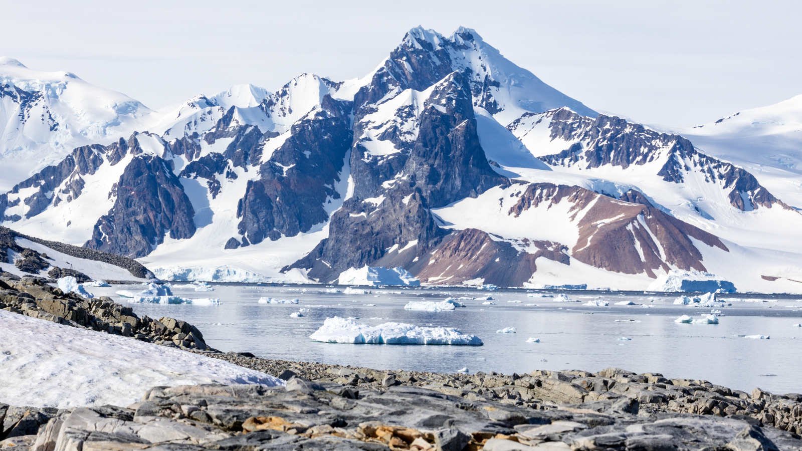 It's easy to see features like Stonington Island off the west coast of Graham Island, Antarctica, but now a new map shows scientists what lies beneath in unprecedented detail.
(Image credit: kitz-travellers/Getty Images)
Share
Share by:
It's easy to see features like Stonington Island off the west coast of Graham Island, Antarctica, but now a new map shows scientists what lies beneath in unprecedented detail.
(Image credit: kitz-travellers/Getty Images)
Share
Share by:
- Copy link
- X
Scientists have mapped the bedrock beneath Antarctica's massive ice sheet in unprecedented detail, revealing hidden structures that form the glacier.
The ice sheet, which spans more than 5.4 million square miles (14 million square kilometers), shrouds underlying mountains, valleys, lakes and basins, according to a new study published in the journal Science on Thursday (Jan. 15).
You may like-
 Melting of West Antarctic ice sheet could trigger catastrophic reshaping of the land beneath
-
 Hundreds of iceberg earthquakes are shaking the crumbling end of Antarctica's Doomsday Glacier
-
 6 million-year-old ice discovered in Antarctica shatters records — and there's ancient air trapped inside
Yet much about the landscape under the ice has been uncertain, because ground and air surveys are difficult in the region. Scientists often estimate information between distant or irregular survey points, for example, which can miss valleys in the bedrock that guide ice flow.
In the new study, researchers addressed this gap by combining high-resolution satellite images of the ice sheet surface with ice thickness measurements, and an ice flow analysis based on the physics of how ice flows over bedrock. The scientists integrated these data to create a continent-scale map of Antarctica's topography under the ice.
Image 1 of 2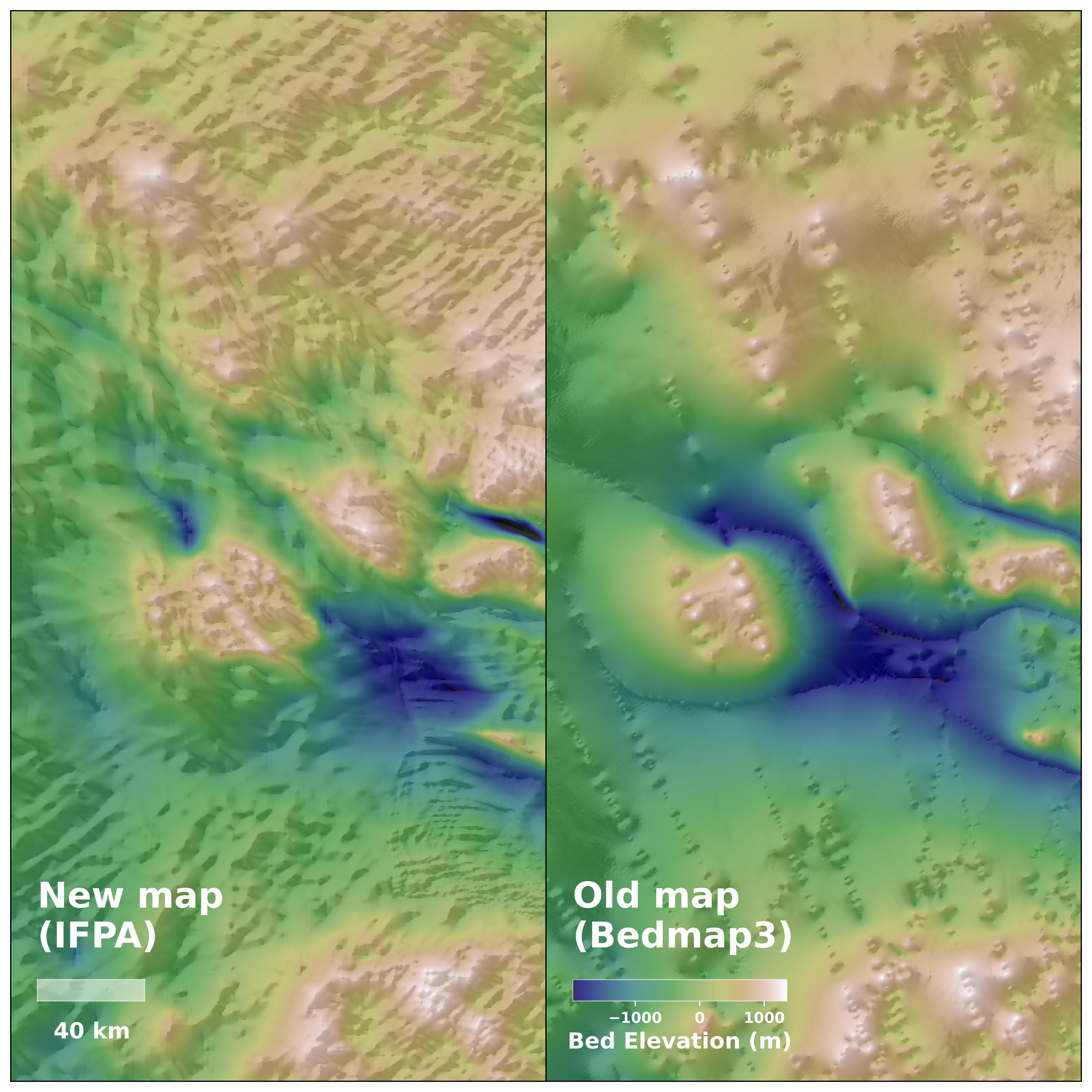 (Image credit: Helen Ockenden)
A new map of the hidden features beneath Antarctica's ice shows the icy continent in unprecedented detail.
 (Image credit: Helen Ockenden)
The new topography map details previously unknown features in the landscape beneath Antarctica, including hills and ridges and even details of entire mountain ranges.
RELATED STORIES—Mega-iceberg A23a, formerly the world's largest, turns into bright 'blue mush' as it finally dies after 40 years at sea
—50 amazing facts about Antarctica
—What's hiding under Antarctica's ice?
The extensive map revealed features 1.2 to 18.6 miles (2 to 30 kilometers) beneath the ice sheet that were previously unknown or unclear to science, such as river channels stretching hundreds of miles, which could be traces of the landscape predating the ice sheet.
The map also uncovered sharp transitions between highland and lowland terrain, suggesting tectonic boundaries. In one region where previous air surveys had predicted an ancient river landscape covered by ice, the new map actually identified deep valleys underneath.
The map enables scientists to observe how the ice sheet has evolved and interacted with underlying topography. Visualizing the processes affecting these glaciers can improve models of ice sheets and make projections of climate change-driven ice melt and sea-level rise more exact.
Antarctica quiz: Test your knowledge on Earth's frozen continent
 Olivia FerrariLive Science Contributor
Olivia Ferrari is a New York City-based freelance journalist with a background in research and science communication. Olivia has lived and worked in the U.K., Costa Rica, Panama and Colombia. Her writing focuses on wildlife, environmental justice, climate change, and social science.
Show More CommentsYou must confirm your public display name before commenting
Please logout and then login again, you will then be prompted to enter your display name.
Logout Read more Melting of West Antarctic ice sheet could trigger catastrophic reshaping of the land beneath
 Hundreds of iceberg earthquakes are shaking the crumbling end of Antarctica's Doomsday Glacier
 6 million-year-old ice discovered in Antarctica shatters records — and there's ancient air trapped inside
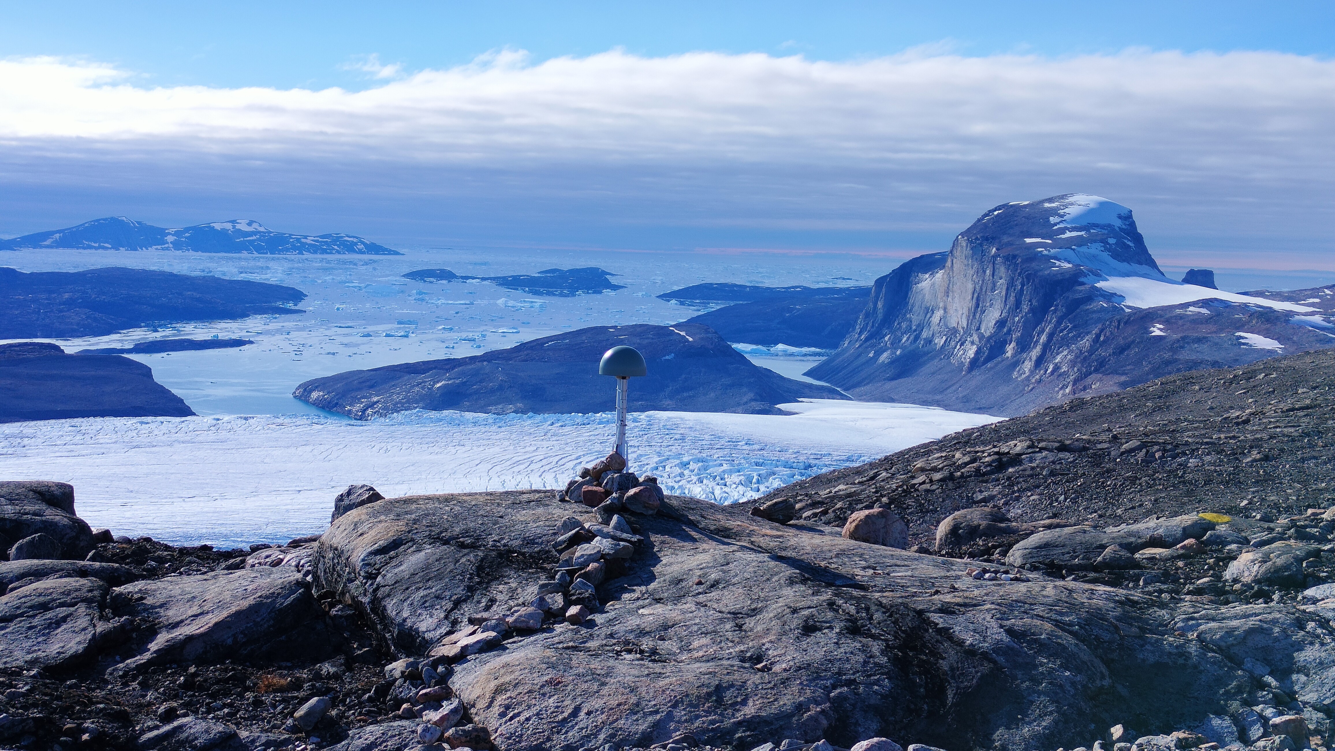 Greenland is twisting, tensing and shrinking due to the 'ghosts' of melted ice sheets
 Huge ice dome in Greenland vanished 7,000 years ago — melting at temperatures we're racing toward today
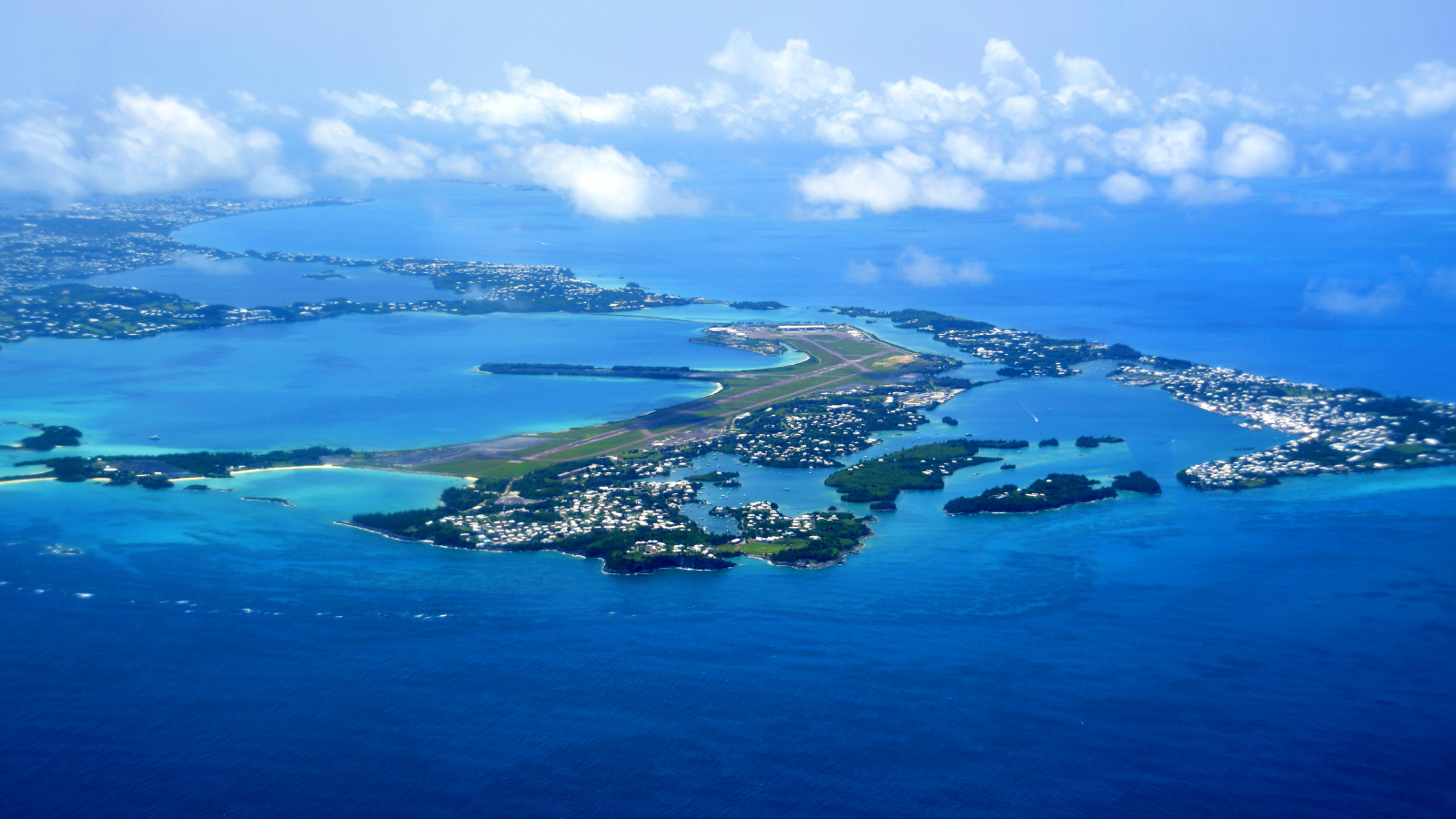 Giant structure discovered deep beneath Bermuda is unlike anything else on Earth
Latest in Planet Earth
Giant structure discovered deep beneath Bermuda is unlike anything else on Earth
Latest in Planet Earth
 Last year, the oceans absorbed a record-breaking amount of heat — equivalent to 12 Hiroshima bombs exploding every second
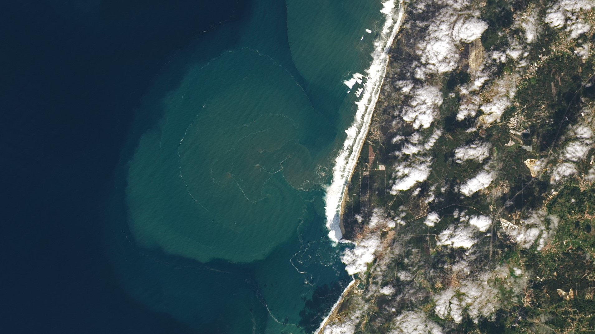 Giant underwater plumes triggered by 7-story waves at Nazaré captured off Portuguese coast
 Forced closure of premier US weather-modeling institute could endanger millions of Americans
 Scars from ancient 'megaquakes' at Cascadia subduction zone discovered in deep-sea landslides
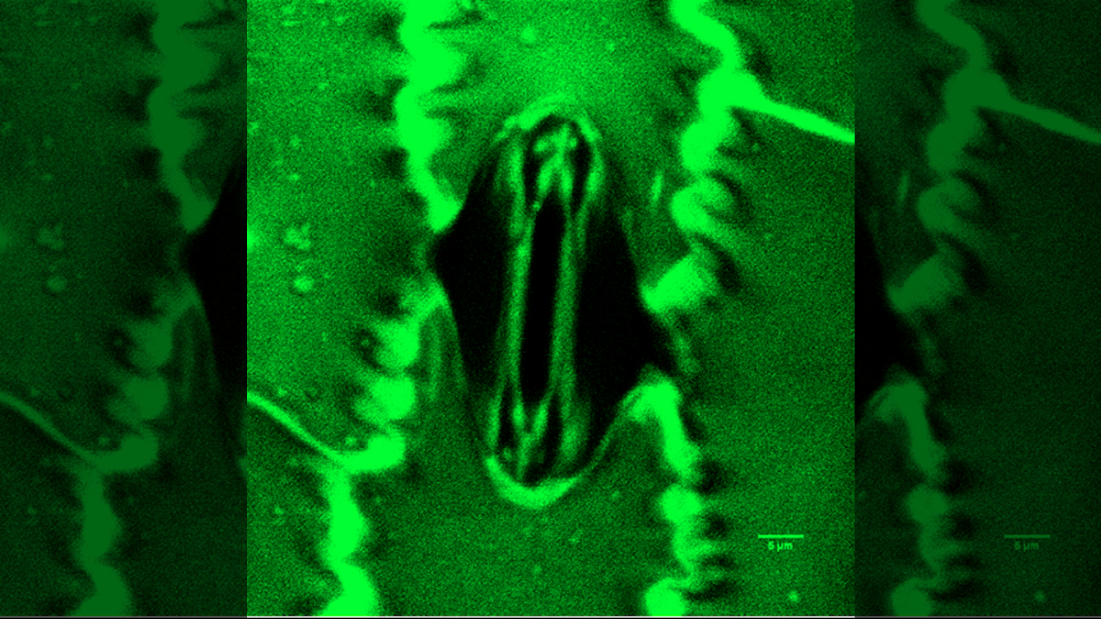 Scientists watch microscopic plant 'mouths' breathing in real time with palm-sized tool
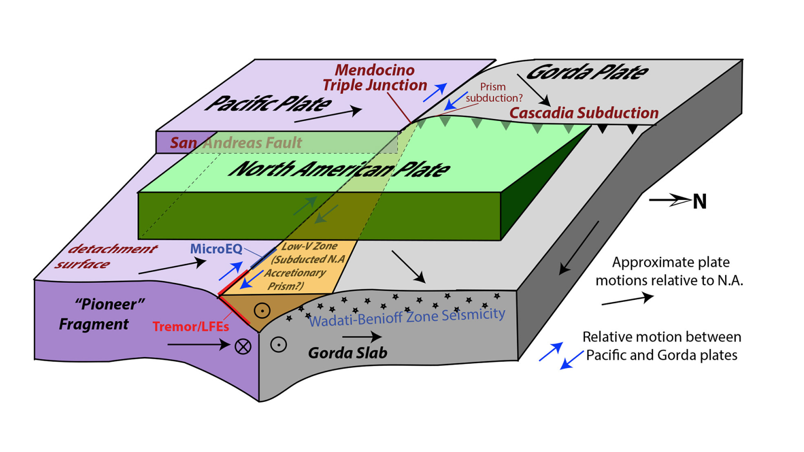 Fragment of lost tectonic plate discovered where San Andreas and Cascadia faults meet
Latest in News
Fragment of lost tectonic plate discovered where San Andreas and Cascadia faults meet
Latest in News
 Color blindness linked to lower bladder cancer survival, early study hints
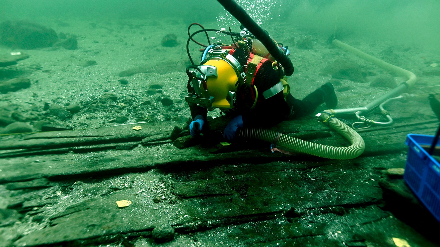 Medieval 'super ship' found wrecked off Denmark is largest vessel of its kind
 Ever watched a pet cow pick up a broom and scratch herself with it? You have now
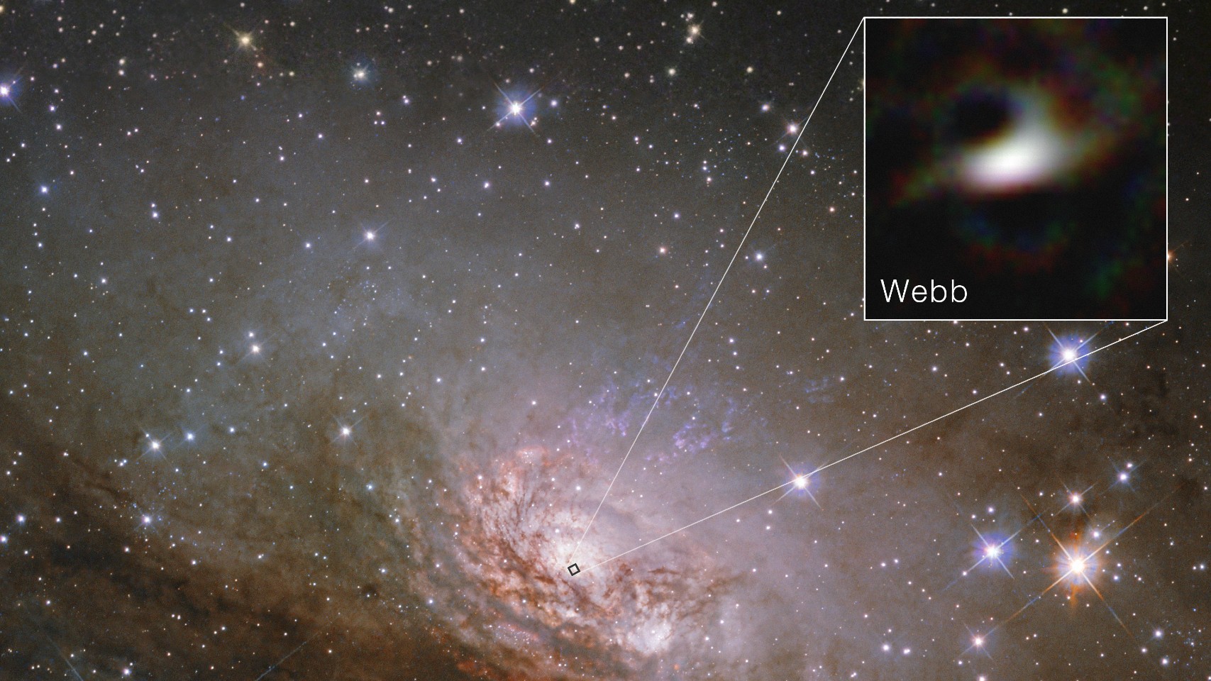 James Webb telescope reveals sharpest-ever look at the edge of a supermassive black hole
 Why is flu season so bad this year?
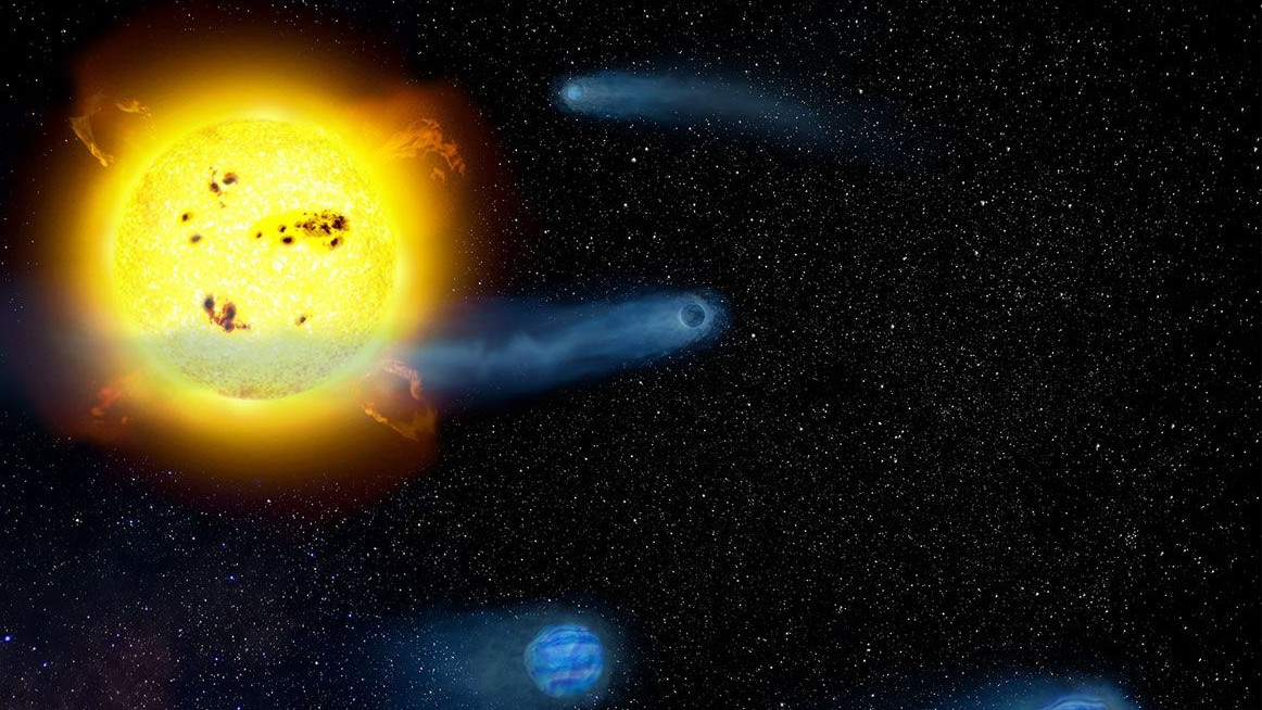 Strange discovery offers 'missing link' in planet formation
LATEST ARTICLES
Strange discovery offers 'missing link' in planet formation
LATEST ARTICLES- 1Medieval 'super ship' found wrecked off Denmark is largest vessel of its kind
- 2Suunto Vertical 2 smartwatch review: Beauty and the beast
- 31,700-year-old Roman marching camps discovered in Germany — along with a multitude of artifacts like coins and the remnants of shoes
- 4Giant underwater plumes triggered by 7-story waves at Nazaré captured off Portuguese coast
- 5Indigenous TikTok star 'Bush Legend' is actually AI-generated, leading to accusations of 'digital blackface'