- Planet Earth
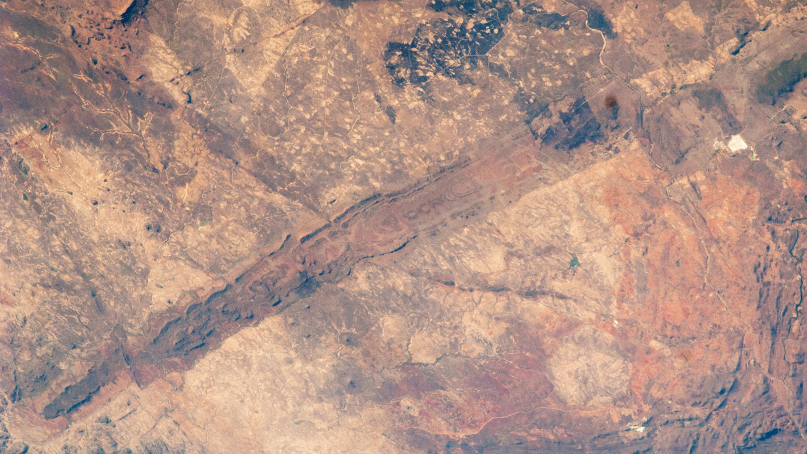
A 2025 satellite photo shows a giant "Y" in the middle of the Taklamakan Desert, where a verdant river and a lengthy "red-white mountain" meet. The intersecting features are also home to an eighth-century fort that was chock-full of ancient artifacts.
When you purchase through links on our site, we may earn an affiliate commission. Here’s how it works.
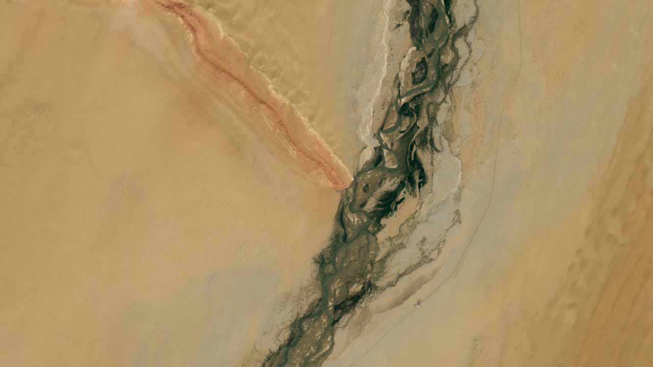
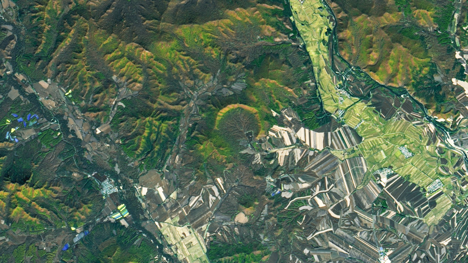
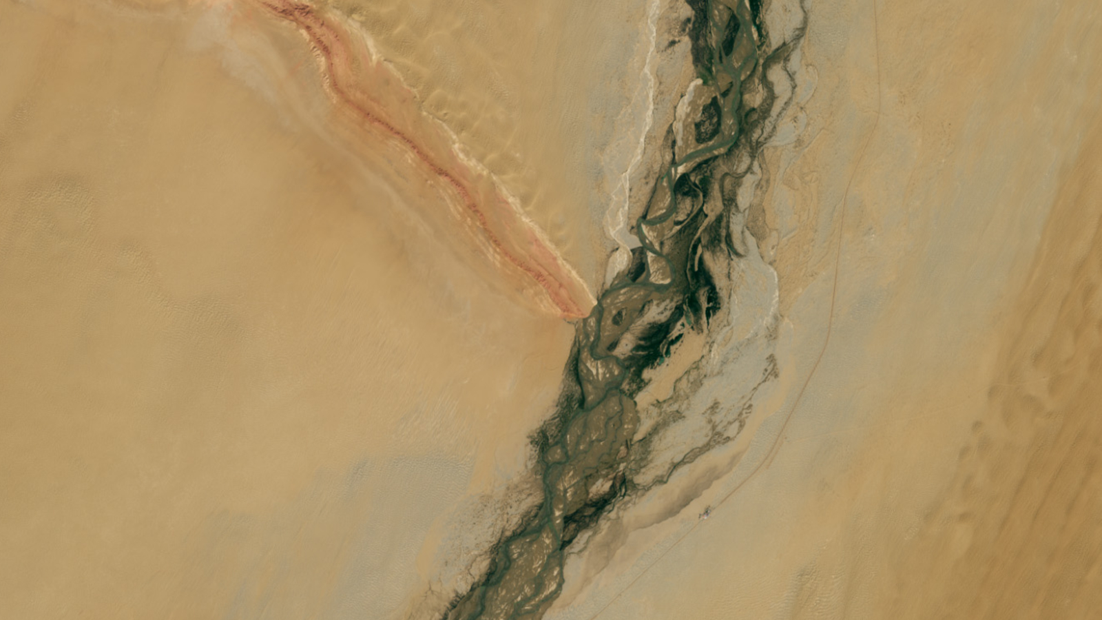 In the heart of China's Takalamakan Desert a winding verdant river and striped rocky ridge for a giant Y-shape structure, which is also home to an ancient fort.
(Image credit: NASA/Landsat 9)
In the heart of China's Takalamakan Desert a winding verdant river and striped rocky ridge for a giant Y-shape structure, which is also home to an ancient fort.
(Image credit: NASA/Landsat 9)
- Copy link
- X
Get the world’s most fascinating discoveries delivered straight to your inbox.
Become a Member in Seconds
Unlock instant access to exclusive member features.
Contact me with news and offers from other Future brands Receive email from us on behalf of our trusted partners or sponsors By submitting your information you agree to the Terms & Conditions and Privacy Policy and are aged 16 or over.You are now subscribed
Your newsletter sign-up was successful
Want to add more newsletters?

Delivered Daily
Daily Newsletter
Sign up for the latest discoveries, groundbreaking research and fascinating breakthroughs that impact you and the wider world direct to your inbox.
Signup +
Once a week
Life's Little Mysteries
Feed your curiosity with an exclusive mystery every week, solved with science and delivered direct to your inbox before it's seen anywhere else.
Signup +
Once a week
How It Works
Sign up to our free science & technology newsletter for your weekly fix of fascinating articles, quick quizzes, amazing images, and more
Signup +
Delivered daily
Space.com Newsletter
Breaking space news, the latest updates on rocket launches, skywatching events and more!
Signup +
Once a month
Watch This Space
Sign up to our monthly entertainment newsletter to keep up with all our coverage of the latest sci-fi and space movies, tv shows, games and books.
Signup +
Once a week
Night Sky This Week
Discover this week's must-see night sky events, moon phases, and stunning astrophotos. Sign up for our skywatching newsletter and explore the universe with us!
Signup +Join the club
Get full access to premium articles, exclusive features and a growing list of member rewards.
Explore An account already exists for this email address, please log in. Subscribe to our newsletter QUICK FACTSWhere is it? Taklamakan Desert, China [38.459991514, 80.87050739]
What's in the photo? A river and a mountain range forming a giant Y shape
Which satellite took the photo? Landsat 9
When was it taken? Sept. 11, 2025
This striking satellite snap shows a massive letter Y lurking in the heart of a recently transformed Chinese desert. The unusual shape is made up of a rocky ridge and a winding, gemstone-filled river and is also home to an important eighth-century fort.
The desert was previously considered a "biological void" — meaning it was almost completely devoid of life — due to its high temperatures and aridity. However, an ecological engineering project known as the Great Green Wall has planted more than 66 billion trees along the desert's northern edge since 1974, which has transformed it into a carbon sink that soaks up large amounts of carbon dioxide, recent research revealed.
Article continues below You may like-
 Ancient lake full of crop circles lurks in the shadow of Saudi Arabia's 'camel-hump' mountain
-
 China has planted so many trees around the Taklamakan Desert that it's turned this 'biological void' into a carbon sink
-
 Incomplete remains of world's 'youngest' impact crater spotted lurking in Chinese forest
The Y shape comprises two parts: the Hotan River, which stretches about 180 miles (290 kilometers) across the desert from south to north; and Marzatagh, a "wall-like" mountain ridge that stands around 600 feet (180 meters) above the surrounding sands and extends up to 90 miles (145 km) to the northwest, according to NASA's Earth Observatory.
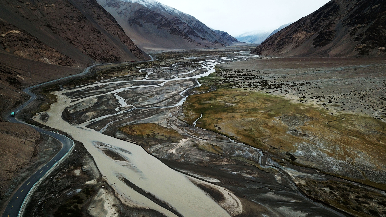
The Hotan River (sometimes called the Khotan River) is fed by glacial meltwater from the Kunlun Mountains south of Taklamakan and appears green due to vegetation that grows between its braided streams. Its waters are rich in both white and green nephrite, which are prized types of jade.
Marztagh is split into seams of reddish iron-rich rocks and paler sandstone, earning it the name Hongbaishan, meaning "red-white mountain" in Chinese. It also acts as a natural barrier for sand that gets blown against the rocky wall, creating a sea of rippling, crescent-shaped "barchan" dunes along its northern edge.
The confluence of drinking water, valuable gemstones and shelter from the elements made this location an important stop on the Silk Road — a massive network of trade routes running from east to west across Asia from the second century to the fifteenth century.
Sign up for the Live Science daily newsletter nowContact me with news and offers from other Future brandsReceive email from us on behalf of our trusted partners or sponsorsBy submitting your information you agree to the Terms & Conditions and Privacy Policy and are aged 16 or over.The point where the two features meet is home to the crumbled remains of a military fort, which likely dates to the eighth century.
Crumbling fort
The fortification, dubbed Mazar Tagh, was built on a hill at the intersection of the Y shape by the Tibetan Empire, which existed between A.D. 618 and 842 and covered most of the Tibetan Plateau, including parts of modern-day China, India and Afghanistan.
The site was first excavated in 1907 by Hungarian-British archaeologist Aurel Stein, who uncovered more than 1,500 document fragments, transcribed on both wood and paper, according to the The International Dunhuang Programme. These texts were written in multiple languages — including Khotanese, Uyghur and Sogdian — and document the soldiers' experiences.
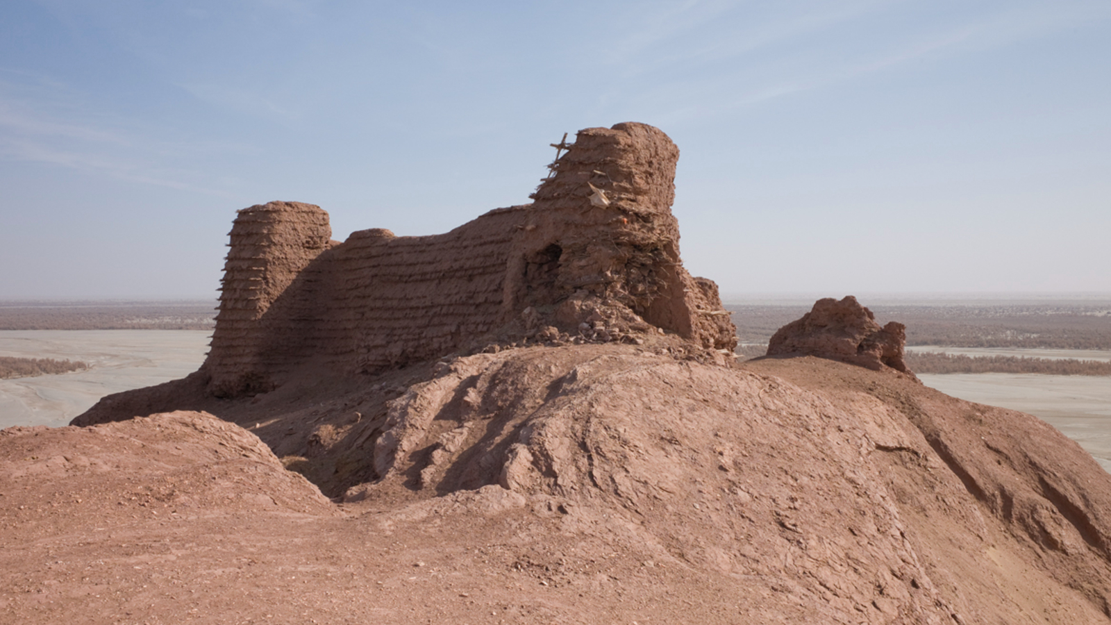
Other artifacts — including arrows, sheathes, shoes, dice, a comb and a pen — were also found at the site and are currently stored at the British Museum. However, the most impressive find was arguably a portrait of a "begging monk" painted on a wooden board, likely by a soldier. The monk was probably on a pilgrimage to an ancient Buddhist shrine that was built on the same hill.
Today, the hill is also home to an Islamic shrine.
Ancient Saudi 'lake shadow'
A 2020 astronaut photo shows the oasis town of Jubbah lurking within a paleolake in the wind shadow of Saudi Arabia's "two camel-hump mountain."
 Rare dusting of snow in Atacama
A 2025 satellite photo shows snowy stripes painted across the Atacama Desert in Chile. The icy weather temporarily put a major telescope into "survival mode."
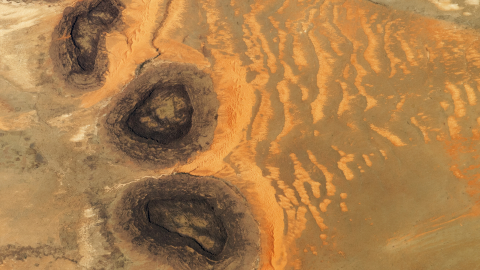 'Black mesa' trio in Sahara
A 2023 astronaut photo shows three dark hills towering above part of the Sahara desert in southern Mauritania. The Paleozoic structures have helped to create a series of striking sand dunes.
TOPICS Earth from space Harry BakerSocial Links NavigationSenior Staff Writer
Harry is a U.K.-based senior staff writer at Live Science. He studied marine biology at the University of Exeter before training to become a journalist. He covers a wide range of topics including space exploration, planetary science, space weather, climate change, animal behavior and paleontology. His recent work on the solar maximum won "best space submission" at the 2024 Aerospace Media Awards and was shortlisted in the "top scoop" category at the NCTJ Awards for Excellence in 2023. He also writes Live Science's weekly Earth from space series.
View MoreYou must confirm your public display name before commenting
Please logout and then login again, you will then be prompted to enter your display name.
Logout Read more
Ancient lake full of crop circles lurks in the shadow of Saudi Arabia's 'camel-hump' mountain
Incomplete remains of world's 'youngest' impact crater spotted lurking in Chinese forest
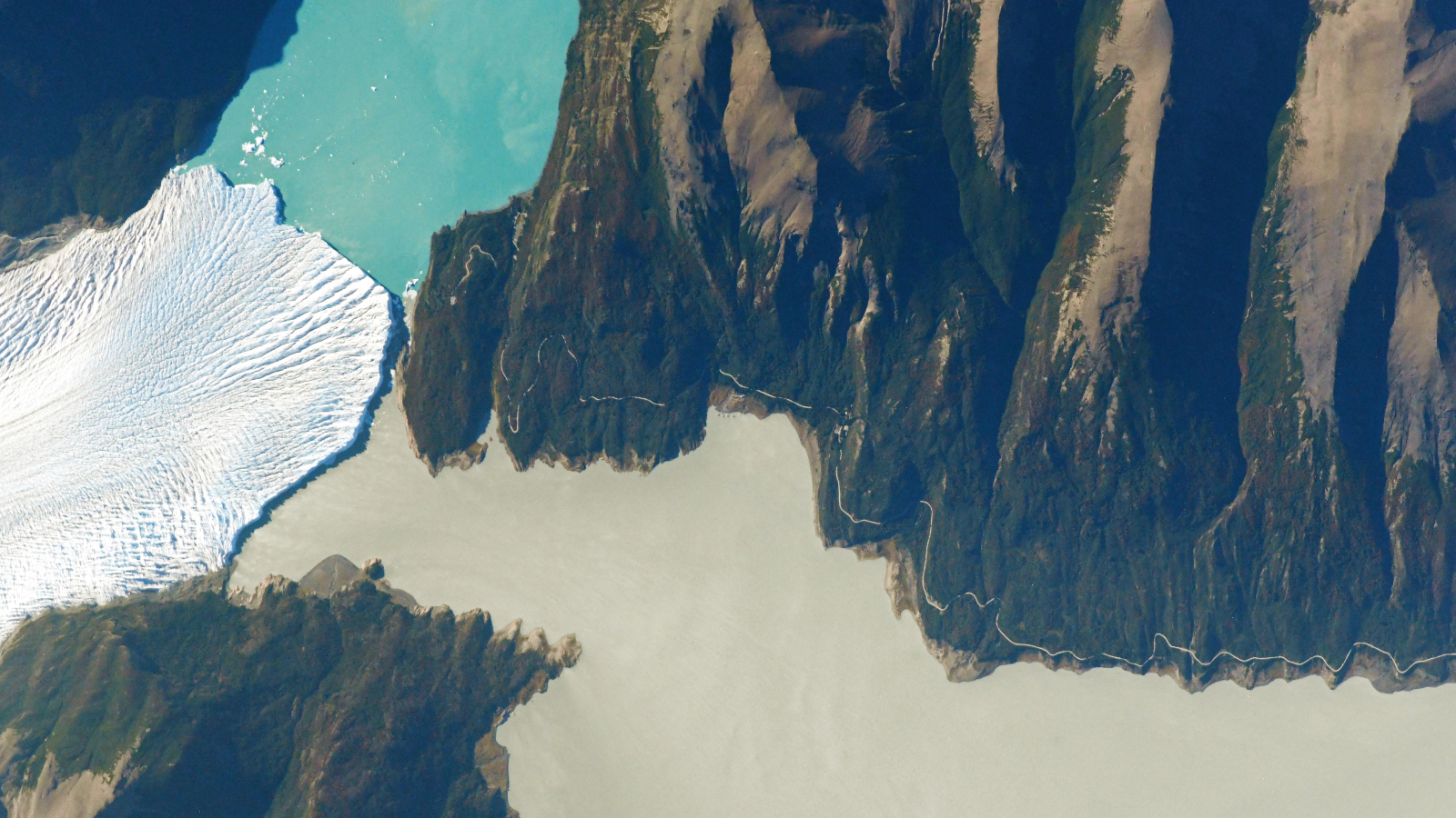 See the exact point where a glacier, a lake and a river 'touch' in Argentina
Rare dusting of snow covers one of the driest place on Earth and shuts down massive radio telescope
See the exact point where a glacier, a lake and a river 'touch' in Argentina
Rare dusting of snow covers one of the driest place on Earth and shuts down massive radio telescope
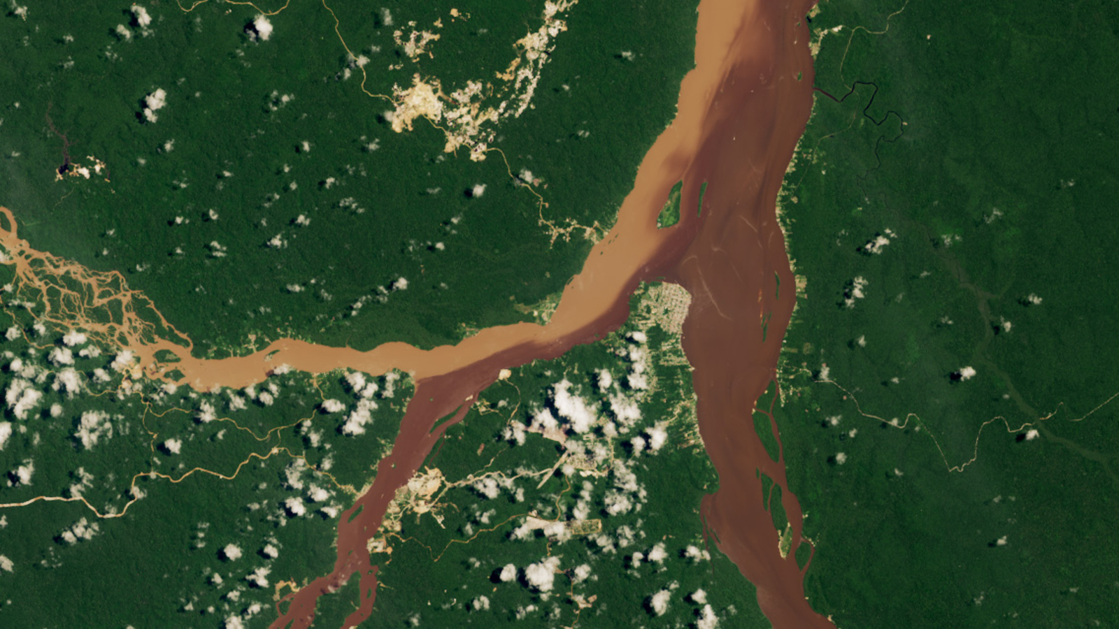 3 rivers merge into striking half-and-half waterway in Guyana
 Hidden beauty of Zimbabwe's 2.5 billion-year-old 'geological marvel' revealed in striking astronaut photo
Latest in Planet Earth
Hidden beauty of Zimbabwe's 2.5 billion-year-old 'geological marvel' revealed in striking astronaut photo
Latest in Planet Earth
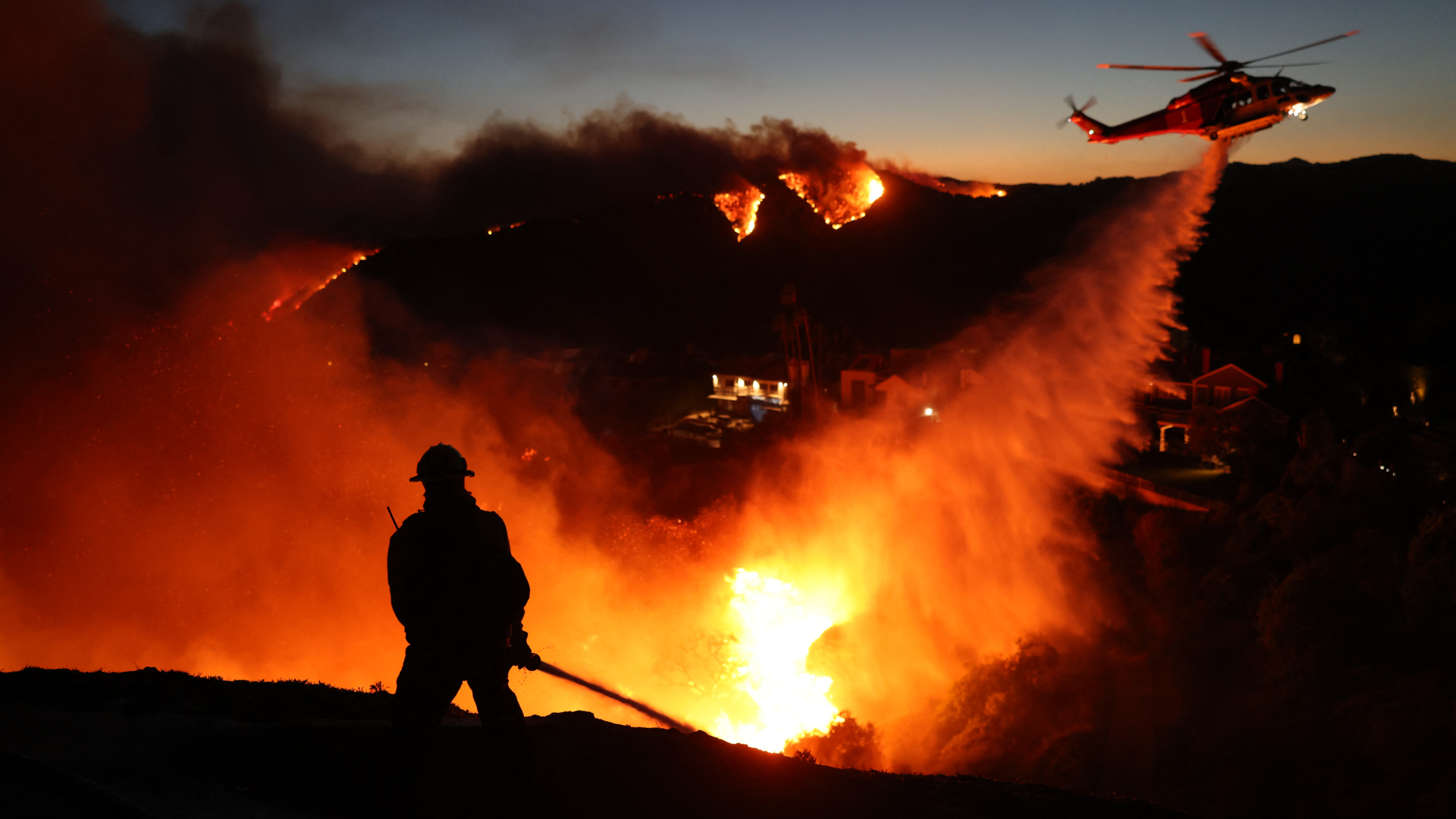 Wildfire season is shifting, but its new time windows vary across Canada and the US drought-prone West
 'The warming trend nearly doubled after 2014': The rate of global warming has accelerated more in the past decade than ever before
 Planting trees in the sea could act as a huge carbon sink and save millions of dollars in storm damage every year. What is stopping us from doing it?
 Vanuatu's 'barefoot volcanologist' stands at ash- and sulfur-spewing Mount Yasur in award-winning photograph
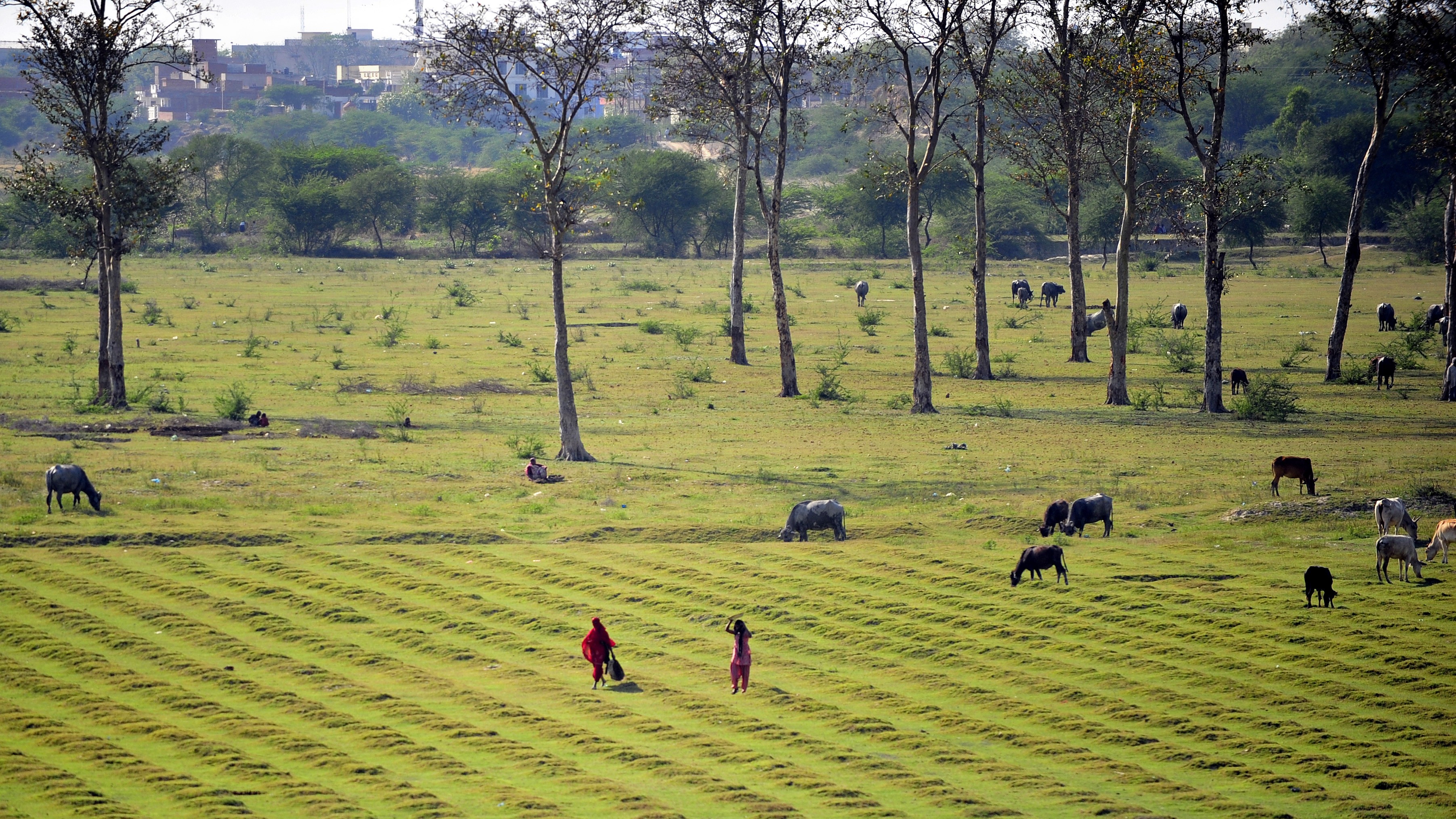 'Humans can't be considered to be separate from the environment': Award-winning scientist Meha Jain on using satellites and real world experiences to help farmers in India facing a precarious future
 Volcanoes: Facts, news, features and articles about geology's fieriest features
Latest in Features
Volcanoes: Facts, news, features and articles about geology's fieriest features
Latest in Features
 'Exposed Cranium' leaks its gory secrets in new James Webb telescope images: Space photo of the week
Gemstone-filled river and striped mountain ridge form massive 'Y' in China's revitalized desert
'Exposed Cranium' leaks its gory secrets in new James Webb telescope images: Space photo of the week
Gemstone-filled river and striped mountain ridge form massive 'Y' in China's revitalized desert
 Why is mercury a liquid?
 Ancient 'alien-like' skulls have been found on every continent but Antarctica. Anthropologists are starting to figure out why.
 Why aren't mammals as colorful as reptiles, birds or fish?
 Asante spider: A rare African sword ornament from Ghana's Gold Coast that later helped a man in Texas barter for his life
LATEST ARTICLES
Asante spider: A rare African sword ornament from Ghana's Gold Coast that later helped a man in Texas barter for his life
LATEST ARTICLES 1Exotic prime numbers could be hiding inside black holes
- 22,000-year-old Phoenician coin was used as bus fare in England, but 'how it got there will always be a mystery'
- 3In people with epilepsy, sleeping after a seizure may trigger more seizures
- 4Wildfire season is shifting, but its new time windows vary across Canada and the US drought-prone West
- 5World's smallest QR code can store data for thousands of years — but you need an electron microscope to see it